Record Detail
Advanced Search
Text
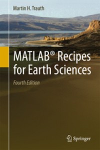
MATLAB® Recipes for Earth Sciences
This book introduces methods of data analysis in geosciences using MATLAB, such as basic statistics for univariate, bivariate and multivariate datasets, time-series analysis, signal processing, the analysis of spatial and directional data, and image analysis. The revised and updated Fourth Edition includes sixteen new sections and most chapters have greatly been expanded so that they now include a step by step discussion of all methods before demonstrating the methods with MATLAB functions. New sections include: Array Manipulation; Control Flow; Creating Graphical User Interfaces; Hypothesis Testing; Kolmogorov-Smirnov Test; Mann-Whitney Test; Ansari-Bradley Test; Detecting Abrupt Transitions in Time Series; Exporting 3D Graphics to Create Interactive Documents; Importing, Processing and Exporting LANDSAT Images; Importing and Georeferencing TERRA ASTER Images; Processing and Exporting EO-1 Hyperion Images; Image Enhancement; Correction and Rectification; Shape-Based Object Detection in Images; Discriminant Analysis; and Multiple Linear Regression. The text includes numerous examples demonstrating how MATLAB can be used on data sets from earth sciences.
Availability
| 2429/PUP/2016 | 550 TRA m c.1 | Perpustakaan Universitas Pertamina | Available |
| 2430/PUP/2016 | 550 TRA m c.2 | Perpustakaan Universitas Pertamina | Available |
Detail Information
| Series Title |
-
|
|---|---|
| Call Number |
550 TRA m
|
| Publisher | Springer : Berlin., 2015 |
| Collation |
xiv, 427 p. : Illust. ; 25 cm
|
| Language |
English
|
| ISBN/ISSN |
9783662462430
|
| Classification |
550
|
| Content Type |
-
|
| Media Type |
-
|
|---|---|
| Carrier Type |
-
|
| Edition |
Ed. 4th
|
| Subject(s) | |
| Specific Detail Info |
-
|
| Statement of Responsibility |
-
|
| Department(s) |
Other version/related
No other version available


